
A recent study has revealed that the heavy rainfall that inundated Southern California two years ago was insufficient to restore the significantly depleted underground aquifers, which have suffered from extensive pumping over the last twenty years.
Researchers at Stanford University examined the impact of the historic storms of 2023 on groundwater levels in Los Angeles and Orange counties. Their findings indicated that while adjacent aquifers showed signs of recovery, the deeper aquifers, those located more than 150 feet below the surface, only regained approximately 25% of the water they had lost since 2006.
William Ellsworth, a seismologist and emeritus professor of geophysics at Stanford who contributed to the study, observed, “Heavy rainfall primarily replenishes shallow aquifers, but it doesn’t necessarily trickle down to the deeper levels.” He emphasized that the prolonged effects of drought on these deeper aquifers remain evident.
The 2023 series of significant storms filled California’s reservoirs after three years of harsh drought conditions. However, the recent study published in Science indicates that even this substantial influx of water only partially addressed the long-term declines in water levels.
Lead author Shujuan Mao, who conducted the research at Stanford and is currently an assistant professor at the University of Texas at Austin, stated, “Our findings reveal that deep aquifers are still significantly depleted. A single season of extraordinary rainfall isn’t enough to reverse the groundwater depletion caused by previous droughts. It is going to require multiple years of ample rainfall for these deeper aquifers to completely recover.”
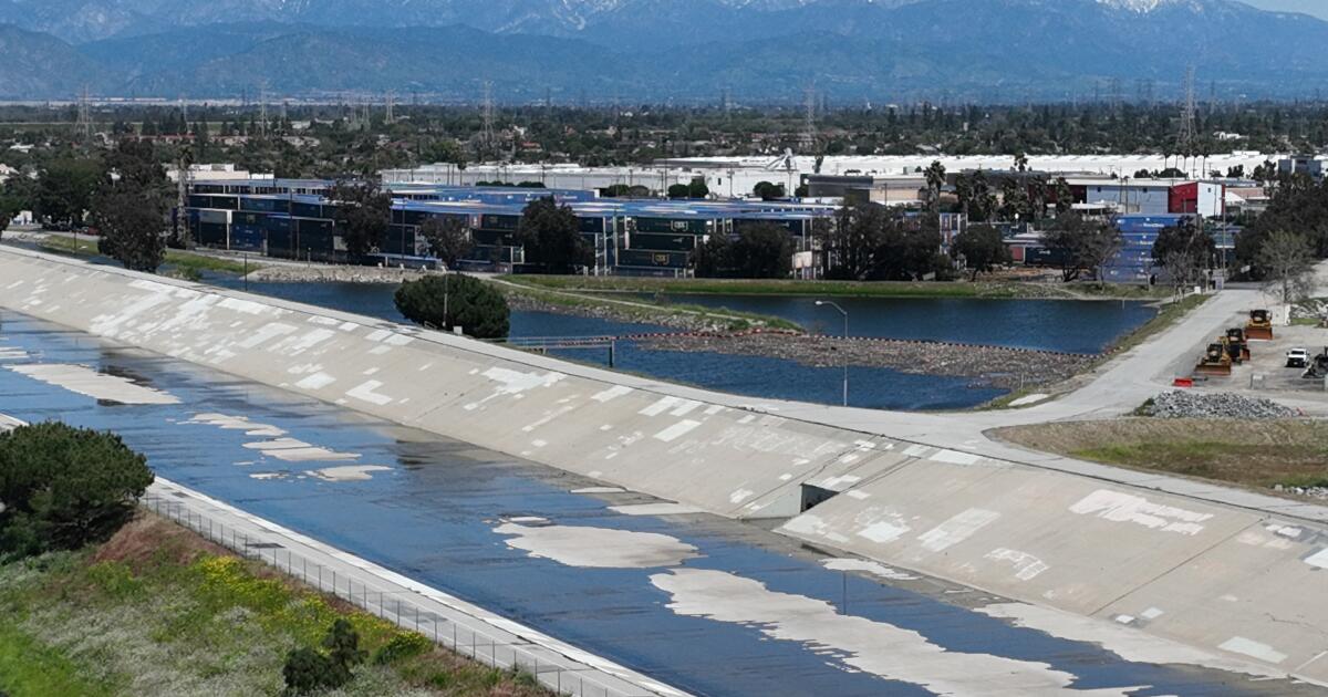
According to the Metropolitan Water District of Southern California, about one-third of the region’s water supply is sourced from groundwater wells. The remainder comes from aqueducts and pipelines transporting water from Northern California, the Colorado River, and the Eastern Sierra.
Naturally, when it rains, water seeps into the ground instead of being diverted into storm drains and concrete channels. In recent years, local agencies have also undertaken projects to direct stormwater towards spreading basins or utilized purified wastewater to recharge groundwater.
Municipal wells generally extract drinking water from hundreds of feet below the surface, usually accessing aquifers situated beneath impermeable layers of clay and silt known as aquitards, which can hinder the advancement of water and slow infiltration to deeper levels.
The researchers hope their findings will provide vital data to local water officials, assisting in water management and conservation decisions while directing groundwater replenishment initiatives.
To monitor groundwater levels efficiently, the team employed seismic data captured by California’s extensive earthquake monitoring network, which comprises numerous highly sensitive seismometers.
Instead of focusing on seismic activity, Mao and her colleagues tracked subtle underground vibrations—described as “background noise”—resulting from ocean waves, vehicular traffic, passing trains, and winds sweeping through mountain passes.
“These vibrations are constantly present in the earth from various sources,” Ellsworth remarked. “By analyzing the speed of seismic waves, we can gauge the status of the aquifers.”
This innovative technique, known as seismic interferometry, is groundbreaking in its ability to provide detailed assessments of groundwater levels at varying depths, reaching as far as 2,600 feet below the surface.
Mao introduced a novel “seismic drought index” to evaluate water deficits across different depths. Traditional methods of measuring groundwater levels in deeper aquifers often involve costly deep well drilling, which limits data collection to singular locations. In contrast, this new seismic approach allows for monitoring water levels across extensive groundwater basins at a significantly lower cost.
Ellsworth emphasized that this new method is a transformative tool for aquifer research.
Gregory Beroza, a co-author and professor of Earth science at Stanford’s Doerr School of Sustainability, remarked that this advancement could revolutionize groundwater management. “We’re moving toward a future where we can evaluate groundwater recharge levels—how much water there is and where it flows—similar to how we monitor surface water with stream gauges,” he noted.
The study explored trends in several watersheds and groundwater basins, focusing on large basins such as the San Gabriel Basin, Los Angeles Central Basin, and Santa Ana Basin, alongside smaller basins like Santa Monica and Hollywood.
While some areas experienced significant groundwater replenishment after the storms, others saw less recharge. For instance, notable increases in groundwater levels were recorded in parts of the San Gabriel Valley, including the deep aquifers at the base of the San Gabriel Mountains.
Interestingly, the study indicated that the Santa Ana Basin in Orange County did not show substantial long-term aquifer depletion over the past two decades, suggesting that local managed recharge programs have been effective.
One key contributor to this success is Orange County’s Groundwater Replenishment System, which facilitates the percolation and injection of purified wastewater into the aquifer for later use.
According to Roy Herndon, chief of hydrology for the Orange County Water District, the study confirms that local groundwater replenishment efforts are “effectively sustaining a viable level of groundwater extraction.”
Additionally, he noted that the study’s findings align with the water-level data maintained by the district.
Herndon pointed out that this research method represents a cost-effective means of leveraging existing seismic sensors to monitor groundwater fluctuations in areas of California lacking sufficient wells dedicated to groundwater level monitoring.