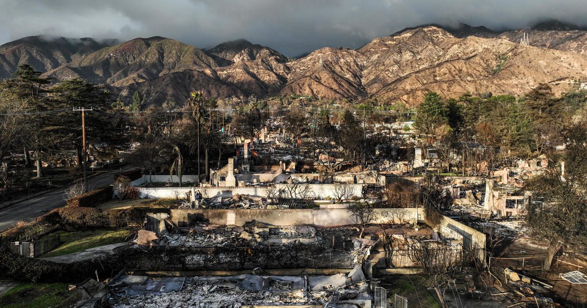

As rain showers approach Los Angeles County, residents living near the Eaton Fire burn area are bracing for possible debris flows.
Residents like Geoff Frank have taken proactive measures by setting up barriers around their properties to redirect any mud or floodwaters that could potentially rush towards their homes.
Frank resides in the Pasadena Glen area, one of the locales most susceptible to debris flows during the impending storm.
A geological survey conducted by the California Department of Conservation has highlighted that communities such as Pasadena, Altadena, and Sierra Madre are especially at risk of significant debris flows due to the aftermath of the Eaton Fire.
“The Eaton Fire greatly increases the chances of substantial post-fire flooding and debris flow incidents,” officials noted in their findings.
The survey has pinpointed the Kinneloa Mesa Section of Pasadena, East Loma Alta Drive in Altadena, and Sierra Madre Canyon as regions particularly vulnerable to serious debris flows.
“This was actually the reason I purchased these barriers, as I had not been overly concerned before,” Frank explained. “The report made it clear that the most hazardous area in Pasadena Glen was the lower glen.”
According to the California Department of Conservation, flooding in the vicinity of the Eaton Fire resulted in significant fatalities in 1938 and 1969. The 1938 flooding caused the tragic deaths of 87 individuals and inflicted about $1.5 billion in damages when adjusted for inflation. Meanwhile, the 1969 floods, although slightly less fatal with 60 casualties, resulted in considerably more destruction, amounting to roughly $3.4 billion in damages when adjusted for inflation.