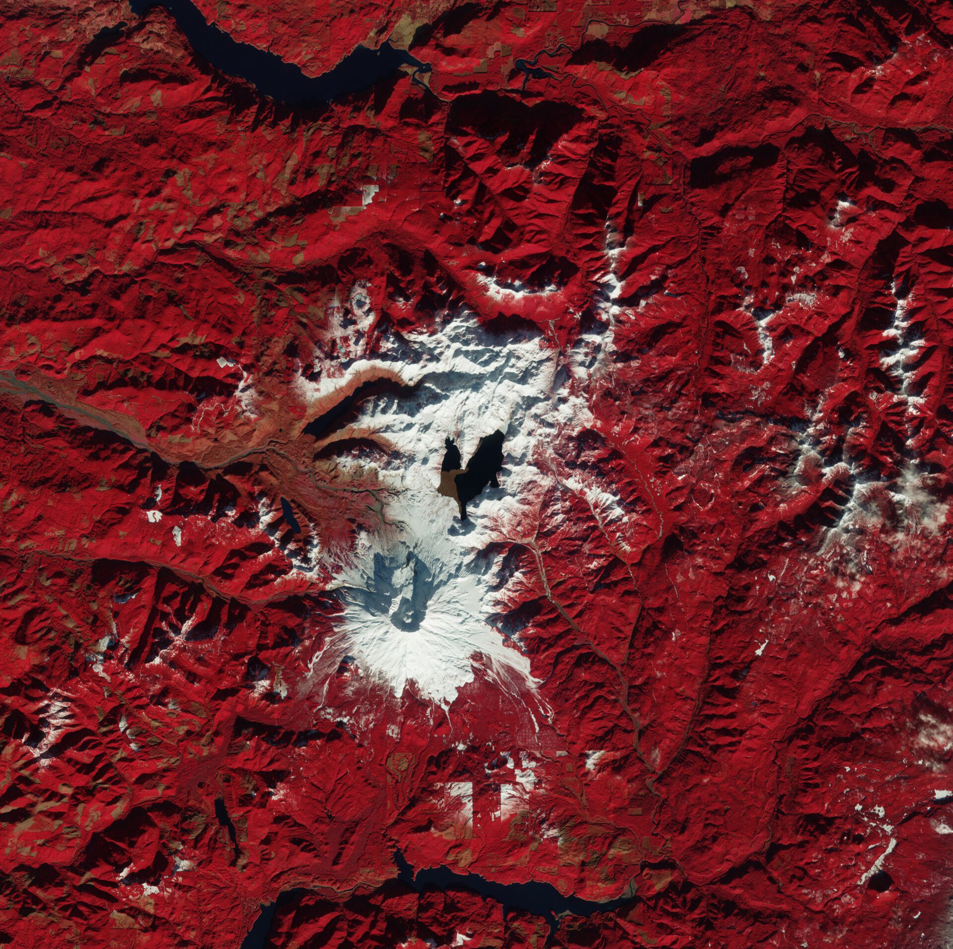

This Valentine’s Day, the Copernicus Sentinel-2 mission shines a spotlight on a heart-shaped formation in the landscape just north of Mount St. Helens in Washington State.
For a detailed view, zoom into this image, which showcases a remarkable 10-meter resolution.
Mount St. Helens is an active volcano famously known for its catastrophic eruption on May 18, 1980. This event is one of the most powerful volcanic blasts ever recorded in North America, resulting in the loss of 57 lives and countless animal casualties, along with the devastation of approximately 500 square kilometers of forest.
The eruption was triggered by a significant earthquake that led to a massive landslide down the volcano’s north face, ultimately resulting in a violent explosion. The eruption released a vast amount of ash and melted snow, ice, and glaciers, generating destructive volcanic mudslides, or lahars, some of which appear as light brown areas, particularly to the northwest of the crater.
This vibrant false-color image, captured in January 2025, has been enhanced using different spectral bands to emphasize areas of vegetation in red, while regions with minimal or no plants appear brown, and water bodies are depicted in dark or black tones.
At the heart of the image, surrounded by snow, lies Spirit Lake—a popular tourist spot for many years prior to the eruption.
Before the eruption, Spirit Lake was a classic alpine lake framed by dense forests. The volcanic explosion and subsequent landslide dramatically altered the lake’s landscape, elevating its surface by approximately 60 meters and reshaping its basin. The eruption also sent thousands of trees tumbling into the lake, forming a significant floating log mat, which is visible in the image as a lighter brown area.
The eruption also disrupted the lake’s drainage system, necessitating the construction of a new tunnel to manage potential flooding. Once the water level stabilized, it resulted in the current heart-shaped outline.
In the lower-central section of the image, rectangular areas indicate land divisions likely designated for timber processing, with brown patches highlighting where trees have been removed. The contrast where the white snow ends reveals a notable drop in elevation in these regions.
Satellite missions like Copernicus Sentinel-2 provide stunning imagery of our planet while playing a crucial role in monitoring remote and unique ecosystems. From their high vantage points, these satellites consistently capture and analyze changes—both natural and human-induced—offering vital information to help safeguard our environment and its inhabitants.