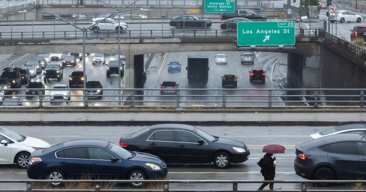

This week, Southern California is bracing for the most severe storm of the year, with meteorologists predicting extensive roadway flooding and the potential for landslides across the region—particularly in areas recently affected by the destructive wildfires in Los Angeles County.
The impending rain is anticipated to far exceed the milder storms that have contributed beneficial moisture over the last fortnight. Officials are advising residents to limit travel on Thursday, as conditions could become hazardous.
“Thursday is not an ideal day for driving,” warned Ryan Kittell, a meteorologist with the National Weather Service in Oxnard. “Expect slick roads and numerous traffic incidents. While flooding won’t affect every area, it’s likely to be more prevalent than we have seen this winter so far.”
Kittell further suggested, “If you can postpone, reschedule, or cancel events—especially those planned for Thursday—it’s highly recommended.”
Forecasts indicate that rainfall amounts could reach between 1.5 to 3 inches across much of Los Angeles, Ventura, and Santa Barbara counties, with mountain regions, such as the Palisades and San Gabriels, possibly receiving between 3 to 6 inches.
The heaviest rainfall is expected from 2 p.m. Thursday to 2 a.m. Friday, according to Ariel Cohen, another meteorologist from the National Weather Service in Oxnard.
Residents in or near burn areas are advised to consider evacuating their homes before the storm hits. If they stay, they should remain indoors and avoid travel. The National Weather Service warns that the upcoming storm could be the wettest of the winter.
Cohen encourages the public to stay alert and prepare for the rain’s onslaught, especially due to the dangers posed by debris flows—a type of landslide marked by fast-moving water that can carry mud, rocks, and even vehicles down slopes at speeds of up to 35 mph.
“Significant debris flows can create torrents of boulders and mud that are hazardous and potentially deadly,” he cautioned. The likelihood of debris flows in the region is estimated at 50% to 70%.
According to Cohen, “Given the numerous burn scars in the area and the anticipated intensity of the rainfall, we could witness significant debris flows due to the rapid accumulation of rain.”
Should debris flows not occur, street closures around burn scar areas and roads likely to become muddy remain a concern.
Following a wildfire in Pacific Palisades last month that claimed 12 lives and scorched over 23,000 acres, officials have deployed over 7,500 feet of concrete barriers and 6,500 sandbags as preventive measures against erosion. Additionally, crews have prepped catch basins and storm drains to mitigate flooding in anticipation of the heavy rains, as highlighted by Los Angeles Mayor Karen Bass during a press conference.
“City departments are on high alert,” Bass noted, adding that resources from the fire department would be deployed in advance, while the Bureau of Sanitation has readied equipment, including trucks and generators.
“While we are particularly worried about the Palisades and burn areas, all of Los Angeles should take the rain and its impacts seriously,” she emphasized.
Although light rain may arrive on Wednesday, forecasters warn that the most severe risk for flooding and debris flows will occur between 2 p.m. Thursday and 2 a.m. Friday. For instance, downtown Los Angeles may see approximately 2.17 inches of rain from Wednesday through Friday.
This could echo conditions from last year when a similar storm resulted in 8.51 inches of rain over three days, causing damaging mudflows in Beverly Glen, Studio City, Tarzana, Baldwin Hills, and Hacienda Heights.
A flood watch or flash flood watch is likely to be issued for much of Southern California, as well as for areas in the Sierra foothills to the east of the San Joaquin Valley.
The rain will be driven by an atmospheric river—long streams of water vapor that travel from the Pacific Ocean into California, potent enough to deliver up to half of the state’s annual precipitation during just a few events.

Expect much of Southern California and the Sierra foothills to be under a flood watch or flash flood watch later this week.
(National Weather Service)
Key Details:
When to Expect the Storm
Heavy rainfall is forecasted to hit Santa Barbara and San Luis Obispo counties on Thursday, followed by Los Angeles and Ventura counties from Thursday afternoon through Friday morning.
Los Angeles County is projected to experience the heaviest rain starting around 2 or 3 p.m. Thursday, intensifying through the evening, according to Kittell.
“Conditions might begin dry or slightly damp in the morning,” he added, “but will certainly escalate throughout the afternoon hours.”

The most intense rainfall is anticipated in Los Angeles and Ventura counties Thursday night into Friday morning, with Santa Barbara and San Luis Obispo receiving heavy rain on Thursday.
(National Weather Service)
In the Inland Empire, as well as in San Diego and Orange counties, substantial rainfall is forecast for Thursday afternoon and evening. Even though the storm may not be as intense there, it will still be a significant weather event for the season, according to Adam Roser, a meteorologist from the San Diego office.
Thursday will also see the peak effects of the storm in the San Francisco Bay Area and the Sierra Nevada, with shallow landslides possible, as well as localized flash flooding and significant river flooding.
Projected Rainfall Totals
Anticipated rainfall amounts include: Lancaster with around 1.14 inches; Redondo Beach, 2.04 inches; downtown Los Angeles and Long Beach, 2.17 inches; Thousand Oaks, 2.19 inches; Canoga Park, 2.32 inches; Santa Clarita, 2.38 inches; Covina, 3.07 inches; Santa Barbara, 3.25 inches; San Luis Obispo, 3.75 inches; and Cambria, 3.97 inches.
San Luis Obispo County is particularly at risk for increased rainfall, with predictions of 3 to 5 inches, and 5 to 10 inches in mountainous areas.

(National Weather Service)
Receiving about 2 inches of rain during a single storm is not uncommon for downtown Los Angeles. However, such rainfall can lead to localized flooding issues. “In Southern California, we generally experience more intense rain events rather than a sustained light rain,” added Rose Schoenfeld, a meteorologist from the service.
During Wednesday’s lighter rain, Riverside may receive up to three-tenths of an inch; Anaheim and Irvine could see two-fifths; Ontario, Lake Elsinore, and San Clemente might get half an inch; while San Diego, Escondido, and Oceanside may garner up to seven-tenths of an inch.

Map showing projected rain in San Diego and Orange counties as well as the Inland Empire on Wednesday.
(National Weather Service)
For the more intense rain expected Thursday through Friday, San Diego and Escondido might receive between 1 to 1.5 inches; Anaheim, Irvine, San Clemente, Riverside, Lake Elsinore, and Oceanside could get 1.5 to 2 inches; and San Bernardino, Ontario, and Temecula are expected to see 2 to 2.5 inches.
While it’s not typical for places like Orange County to experience 1.5 to 2 inches in a single storm, meteorologist Roser noted, this can happen during winter storm events.

Projected rain totals for Orange County, San Diego, and the Inland Empire on Thursday and Friday.
(National Weather Service)
Further north, areas like San José, Concord, and Livermore may see 1.5 to 2 inches of rain, while San Francisco, Napa, Monterey, and Santa Rosa could receive amounts between 2 to 3 inches, and Big Sur is projected to get 4 to 6 inches.
Bakersfield might see totals ranging from 0.73 to 1.67 inches, Fresno, between 0.82 to 1.78 inches, and Merced could receive 0.60 to 1.36 inches. The Sacramento Valley is likely to have a 50% to 80% chance of receiving an inch of rain, while nearby Sierra foothills and Shasta County have a 50% to 85% chance of accumulating 2 inches or more.
Alert for Burn Areas
Due to one of the driest starts in recorded history for the rainy season alongside a historically destructive fire season, numerous burned areas are on heightened alert for landslide risks, as the loss of vegetation means less soil stabilization.
Experts note that when rain falls at half an inch per hour, the danger of mud and debris flows increases significantly. This rate of rainfall is expected this week, particularly in Los Angeles, Ventura, Santa Barbara, and San Luis Obispo counties. “We anticipate numerous enhanced precipitation cells,” said Kittell, indicating that some cells could develop intense rainfall bands similar to thunderstorms, potentially accompanied by strong winds.

Animated infographic on how a debris flow works
Kittell reiterated that a moderate risk exists for considerable flooding and potential debris flows in burn scar areas. A flood watch will be in effect likely from midday Thursday until Friday morning.
Notable regions of concern include the Eaton fire scar in Altadena, as well as fire scars from the Palisades and Franklin fires in Pacific Palisades and Malibu, and the Bridge fire scar located west and southwest of Wrightwood.

A flood watch will be in effect this week for recent burn areas across Los Angeles and Ventura counties.
(National Weather Service)
Residents who have returned home to burn scar areas may wish to temporarily relocate, Kittell advised. “If you have the opportunity to stay elsewhere, that’s advisable,” he said, particularly on Thursday.
For those who remain, it’s best to avoid driving in burned regions throughout Thursday.
In higher-elevation areas of San Diego and Orange counties and the Inland Empire, rain is expected to fall at rates exceeding half an inch per hour on Thursday.
Flooding Risks
Prepare for flooding on roadways, including freeways, on-ramps, and off-ramps. Some roads may become impassable due to flooding, and creeks and rivers are likely to rise significantly. Swift-water rescues could be necessary for individuals stranded by rising water levels in rivers and other bodies of water.
In Santa Barbara and San Luis Obispo counties, a moderate risk for small-stream flooding is anticipated, particularly around Cambria and other areas situated downhill from the Santa Lucia Range.
High Winds
The storm is also projected to bring the most powerful winds seen in a rainstorm so far this winter, with peak gusts between 40 and 60 mph in mountainous and desert regions, while other areas may see gusts of 20 to 40 mph.
For instance, downtown Los Angeles and Santa Barbara could experience gusts of 23 mph, while Long Beach might see 26 mph, Redondo Beach 30 mph, Santa Clarita and Canoga Park up to 32 mph, Thousand Oaks 35 mph, Pyramid Lake 37 mph, San Luis Obispo 44 mph, and Lancaster even up to 52 mph.
These strong winds have the potential to down trees and power lines, resulting in electrical outages.
Wind directions are expected to be out of the east at Los Angeles International Airport, which may impact flight operations and lead to delays. There exists a low chance for water spouts and tornadoes, Kittell noted, saying, “I wouldn’t rule out reports of funnel clouds or even waterspouts.”

(National Weather Service)
After the Storm Departs
The storm is expected to move out of the area by Friday, possibly leading into a dry spell, with no significant storms anticipated for most of the following week.
“By Saturday, we should see dry conditions,” Kittell confirmed, with temperature rises expected in the coming week.