
Nestled in the remote expanse of the northwestern Pacific lies an unassuming volcano known as Zavaritzki, a name that may not be familiar to many. This formidable caldera played a significant role in influencing global climate nearly 200 years ago by ejecting massive clouds of ash into the atmosphere.
Situated within the Kuril Islands, Zavaritzki was once largely ignored by explorers and cartographers. However, its relevance surged when scientists connected it to an unexplained shift in weather patterns during the early 19th century.
William Hutchison, a volcanologist affiliated with the University of St. Andrews, conducted a pioneering study that matched ice core samples containing sulfur with the unique rock chemistry discovered on the slopes of Zavaritzki.
Investigating the Zavaritzki Mystery
Ice cores serve as remarkable records of the Earth’s past, preserving mineral and chemical signatures from ancient volcanic eruptions. For many years, volcanologists were puzzled by a major eruption in 1831, unable to determine the volcano responsible for the significant cooling that occurred.
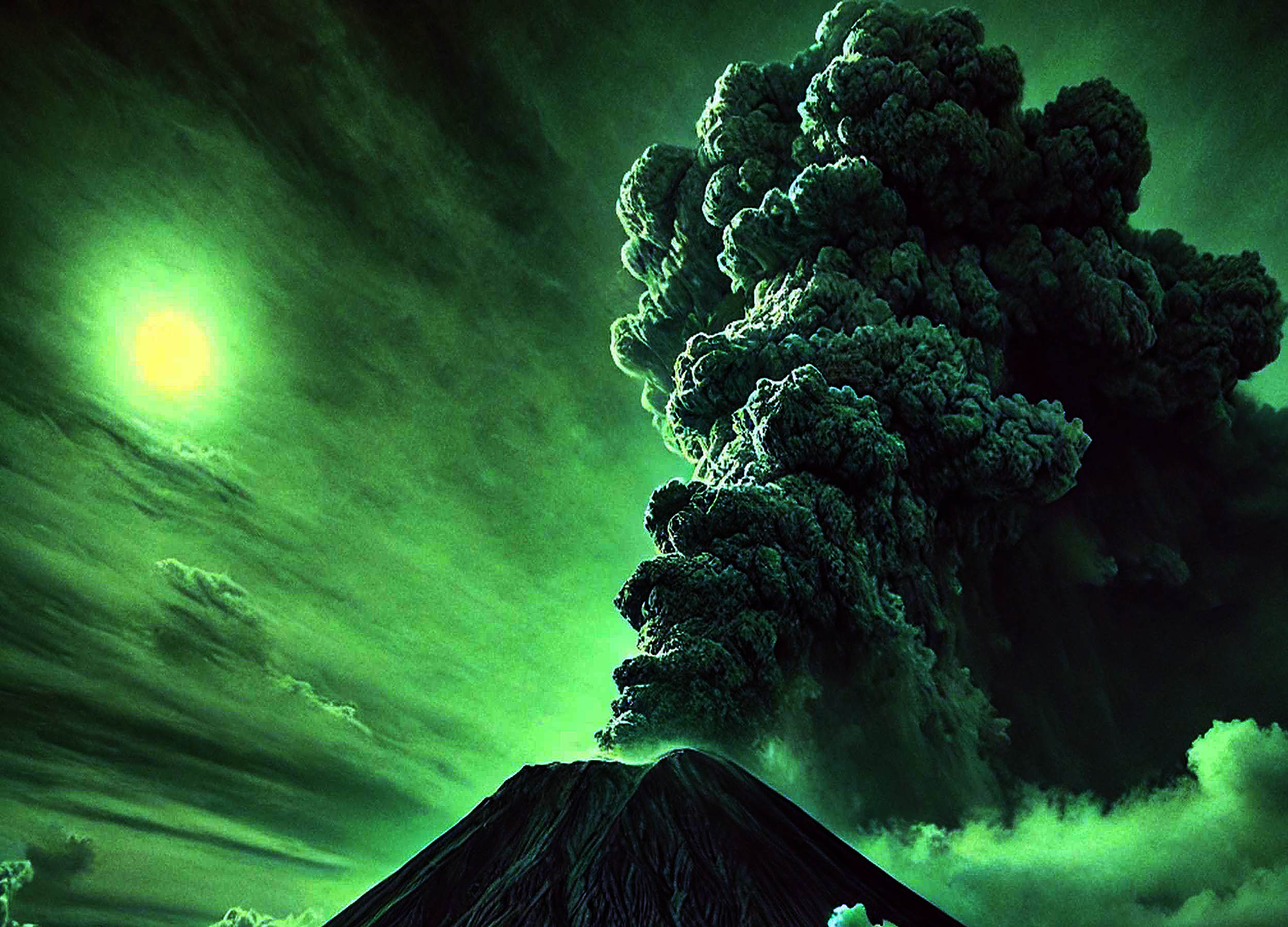
Contemporary journals from that time reflect unusual atmospheric phenomena, including a Sun that appeared greenish, as well as a pronounced drop in temperatures. These indicators suggested a substantial release of volcanic material into the sky.
While scientists speculated that sulfur aerosols might be responsible for reflecting sunlight, the task of pinpointing Zavaritzki as the source was intricate.
The Key to Discovery: Potassium-Poor Ash
As researchers delved deeper, they utilized powerful microscopes to investigate tiny mineral fragments from the ice cores. Their examinations revealed that these particles exhibited low potassium levels, distinguishing them from the compositions found in well-studied volcanoes in Iceland and Alaska.
This finding shifted attention to the Kuril Islands, a remote archipelago that connects northern Japan with Russia’s Kamchatka Peninsula. Further testing confirmed that the mineral shards bore a strong resemblance to fresh samples taken from Zavaritzki’s slopes, marking a significant breakthrough.
Cinder Cones of Zavaritzki’s Complex
The Zavaritzki caldera hosts several cinder cones, which form when gas-rich lava splatters and cools into steep mounds. These formations often develop around larger volcanic vents, accumulating material with each eruption.
Cinder cones can reach heights of several hundred feet, with their slopes capable of maintaining angles of about 30 degrees. Should lava flows breach their sides, these structures may collapse, creating intricate networks of vents and channels.
Monogenetic cones generally appear from single eruptive events, though multiple cones can emerge within the same vicinity. The presence of these formations within Zavaritzki’s caldera suggests a series of intermittent volcanic activity.
Assessing the Eruption’s Impact
Volcanoes that eject sulfur aerosols into the stratosphere can influence climates across vast distances. The eruption in 1831 is believed to have triggered widespread weather fluctuations and a notable drop in temperatures.
Diarists across Europe reported erratic summer storms and hailstorms that devastated crops, while many regions signaled an early onset of colder weather patterns, coinciding with timelines inferred from ice core research.
Radiocarbon dating further substantiated that a notable volcanic event occurred during this period. By aligning carbon signatures from volcanic materials with dated samples, researchers were able to construct a clearer historical chronology.
The Hidden Threats and Lessons of Zavaritzki
Remote volcanoes can unleash significant havoc upon eruption, as they often evade conventional monitoring systems. Hutchison emphasized that eruptions occurring in high-latitude regions can still have far-reaching climatic effects through the dispersion of sulfate aerosols.
Historical incidents, such as the 1991 Pinatubo eruption in the Philippines, exemplify how a single volcano can lead to prolonged global temperature declines. Even with advances in satellite technology, there remains a high risk of neglecting the activities of lesser-known volcanoes.
In response, scientists are focusing on enhancing cooperative measures to amplify monitoring networks. Improving early detection could mitigate the impacts of volcanic eruptions on agriculture, infrastructure, and public health.
Exploring the Submerged Features
Several volcanoes in the Kuril Islands are partially submerged, resulting in flooded calderas where ocean waters filter in. Others feature steep-walled depressions adorned with cinder cones and small lakes, resembling the unique landscape of Zavaritzki.
During the Cold War, parts of this archipelago accommodated submarines and covert bases. Today, geologists study the remnants of ancient eruptions to better understand the geological evolution of these islands.
The Significance of the Zavaritzki Eruption
Major volcanic eruptions leave behind essential traces in ice cores, tree rings, and historical documents. These indicators provide insights into the Earth’s reaction to sudden ash and gas emissions.
Events far away can disrupt agriculture, freeze lakes, and alter weather systems, reminding us of our planet’s interconnected atmosphere. Grasping these dynamics is crucial for preparing for future eruptions that might take us by surprise.
The Zavaritzki eruption emphasizes the necessity for vigilance in monitoring all regions of our planet, no matter how isolated, to avert potential disasters stemming from unexpected volcanic activity.
This research has been published in the Proceedings of the National Academy of Sciences.
—–
Enjoyed our insights? Subscribe to our newsletter for captivating articles, exclusive content, and the latest updates.
Discover more on EarthSnap, a free app created by Eric Ralls and Earth.com.
—–