
CNN
—
A major storm is approaching Southern California, marking the most significant weather event in over a year and raising concerns about life-threatening debris flows in the Los Angeles area, impacted by the devastating wildfires that occurred last month.
This storm is one of three winter systems affecting the region this week, driven by a vigorous weather pattern that has unleashed snow, ice, and rain across much of the United States since the start of the month. Another storm is currently bringing heavy snowfall to the Plains and Midwest.
Evacuation alerts have been raised in Southern California, particularly in areas previously scorched by wildfires, as preparations are made to prevent potential debris flow disasters ahead of the storm’s peak impact expected on Thursday.
Here’s the latest update:
Meteorologist Ariel Cohen from the National Weather Service in Los Angeles has warned that this forthcoming storm is predicted to be the “most significant” of the winter season so far, with forecasted “very intense” rainfall.
Lighter rain is expected to affect Southern California on Wednesday, but the main event is slated for Thursday, when much heavier rainfall is anticipated.
Many regions within Los Angeles and Ventura counties—especially those impacted by the Palisades and Eaton fires—are facing a Level 3 out of 4 flood risk on Thursday, according to the Weather Prediction Center. An additional 36 million residents across California are under a Level 2 flood risk, including areas from San Francisco to San Diego.
Heavy rainfall poses an even greater threat to regions recently affected by catastrophic wildfires. An evacuation warning has been issued for residents in “areas within and near the Lake Fire burn scar” in Santa Barbara County, as reported by the Sheriff’s office on Tuesday.
Additional evacuation alerts and orders are anticipated in LA Fire zones prior to the storm’s peak conditions beginning Thursday, officials have indicated.
“We anticipate that evacuations will occur in certain high-risk zones that have been identified,” stated LA County Sheriff Robert Luna during a press conference on Wednesday.
Residents in Altadena and Malibu Hills have been informed about potential impacts from mud or debris flows, according to Luna. Search and rescue teams, as well as deputies and helicopter units, remain on standby to respond to incidents in burn areas.
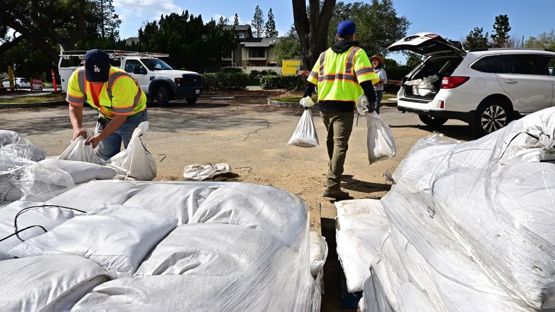
The risks associated with burn scar areas are heightened as officials continue efforts to clear hazardous debris left over from the fires. Los Angeles County has recently increased storm preparations by cleaning debris basins, erecting concrete barriers, and positioning sandbags in fire-prone zones to mitigate debris flow and safeguard storm drains.
Over 7,500 feet of concrete barriers and more than 6,500 sandbags have been distributed to regions impacted by the Palisades Fire in preparation for potential debris flows, announced Los Angeles Mayor Karen Bass on Tuesday. Preparations for the Eaton Fire burn scar are also currently underway, as confirmed by California’s Office of Emergency Services.
The flood threat on Thursday is not limited to wildfire-affected areas.
“Even beyond the burn scars, we are facing the possibility of significant urban flooding,” Cohen cautioned.
The storm is expected to deliver 1 to 3 inches of rain over the Los Angeles basin, with mountain areas potentially receiving totals near 6 inches, particularly in the Palisades Fire burn scar. This marks the heaviest rainfall from a single storm in the region since last year’s severe flooding and mudslides around Los Angeles.
“While we are particularly concerned about the Palisades and burned areas, the implications of this rain should be a concern for all of Los Angeles,” Bass emphasized.
The most intense rainfall is expected from Thursday afternoon into early Friday morning, and may be accompanied by damaging wind gusts capable of uprooting trees, downing power lines, and dispersing debris.
Snow and Ice Impacting Central and Eastern States
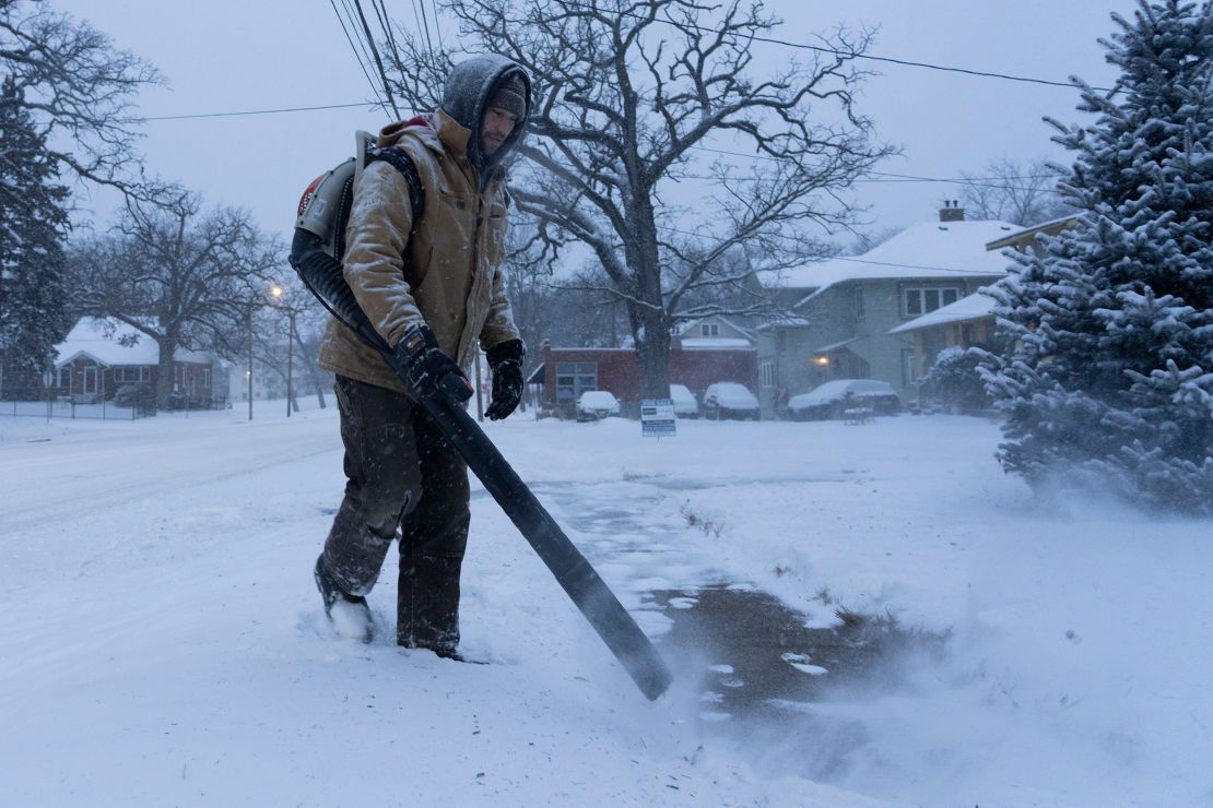
Another severe winter storm is currently impacting the eastern United States. Snow from a newly formed storm that developed overnight in the Plains extended into the Midwest by Wednesday afternoon, while a storm that affected the East since Tuesday continued to bring rain and ice to various areas.
The storm on Wednesday is forecasted to deliver Chicago its most substantial snowfall of the winter season. Snowfall began in the city late Wednesday morning, accumulating up to 6 inches before tapering off overnight. Chicago, which typically sees around two feet of snow by this time of year, has recorded just over 7 inches since December. Areas north of the city may see double-digit snowfall totals, especially near the Illinois-Wisconsin border.
Several schools in the Chicago area opted for closure or transitioned to online learning on Wednesday due to the storm’s impact. Public schools in Kansas City, Missouri, and various districts in Nebraska also announced closures.
Additionally, winter weather caused disruptions in air travel on Wednesday. By early afternoon, over 400 flights in and out of U.S. airports were canceled, and more than 2,800 flights faced delays, as reported by FlightAware.com. The heaviest impact on airport operations was noted in Chicago, St. Louis, and Washington, D.C.
The snow is expected to reach portions of the Northeast by Wednesday evening and continue through much of Thursday. Ice is predicted to mix with the snow in parts of Pennsylvania and New York by Wednesday evening and spread to areas in New England overnight.
Ice accumulation is anticipated to pose significant challenges just south of the heaviest snowfall. A light glaze of ice could create hazardous travel conditions from Oklahoma and Kansas through the Ohio Valley and into the Northeast through Thursday.
The Appalachians are also expected to experience another round of ice from this storm. According to PowerOutage.us, over 160,000 homes and businesses in Virginia were without power on Wednesday evening due to icy conditions from the previous storm.
In Virginia, the combination of ice and over a foot of snow caused significant travel disruptions on Tuesday, resulting in at least 305 accidents reported statewide, with injuries occurring in at least 24 of these incidents as reported by state police.
Maryland also reported more than 200 accidents due to winter weather conditions, according to state police.
The storm on Wednesday is also revitalizing rainfall and thunderstorms in the South.
Heavy rainfall and thunderstorms prompted multiple flash flood warnings as they moved from Texas into Louisiana early Wednesday afternoon. These storms are expected to intensify as they progress eastward throughout the afternoon and evening.
Areas of southern Mississippi and Alabama are under significant threat for damaging storms, as a Level 3 out of 5 risk for severe thunderstorms has been assigned by the Storm Prediction Center.
There is a possibility that some of these thunderstorms could escalate into severe storms, potentially generating a few tornadoes from Louisiana to Georgia starting in the afternoon and lasting into the evening.
The National Weather Service in Mobile, Alabama, has warned of the potential for strong tornadoes, possibly an EF2 or stronger, amidst the most violent storms on Wednesday morning.
A number of these tornadoes may develop after dark, increasing their danger as nighttime conditions make them more difficult to detect, even for those who may be alerted by warnings.
Nocturnal tornadoes are known to be twice as likely to result in fatalities compared to those that occur during daylight hours, a study published in 2022 highlighted.
A recent tornado in Tennessee tragically resulted in loss of life, demonstrating the serious risks posed by such storms after dark.
This report includes contributions from CNN’s Michelle Watson, Hanna Park, and Stephanie Elam.